The applied methodology of GeoCine Group, slightly modified over the years, is common to all three projects the group has directed since 2014: El espacio geográfico de Madrid en el cine y su potencial turístico (The geographic space of Madrid in film and its tourism potential), ending in 2017, and in the projects: Las ciudades españolas en la ficción audiovisual. Registro documental y análisis territorial y audiovisual (Spanish cities in audiovisual fiction. A document registry and territorial and audiovisual analysis) (FACES) and La ficción audiovisual en la Comunidad de Madrid: lugares de rodaje y desarrollo del turismo cinematográfico (Audiovisual fiction in the Madrid Region: filming locations and the development of screen tourism) (FICMATUR), both ongoing.
Our methodology entails the following phases:
Sample selection and delimitation of contents
An inventory has been created of movies and series filmed in Spain for use as the main Internet Movie Data base (IMDb) source, complemented by a specialized bibliography.
The corpus for this project is made up of series and movies filmed up to and including the year 2018. The criteria selection corresponds to IMDb user ratings, taking into account those with a minimum of 750 votes.
Creation of the image bank
The selected productions are time-coded to choose all the clips in the outdoor locations and transportation infrastructures in the different areas analyzed: natural, rural and urban spaces in the Madrid Region.
A frame is extracted from each clip, inventoried according to the established categories of analysis.
Categories of analysis
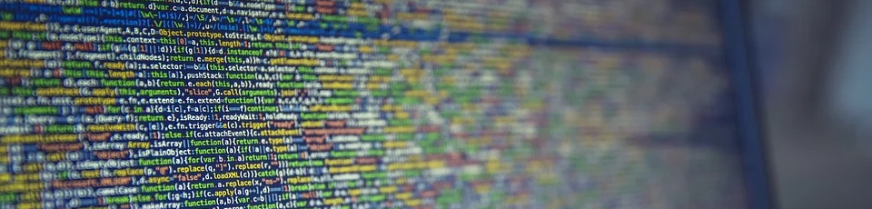
The categories for the metadata in the database correspond to a geographic as well as audiovisual perspective.
Identification data productions: TOriginal title, title in Spanish, director or showrunner, year, format, season and episode - if it is a series -, genre, producer, country where produced, length, reference source, and IMDb identification code.
Clip’s technical information: clip minute within the whole piece, length, type of shot according to camera location and angle, camera movements and editing.
Clip’s narrative and representational features: degree of narrative importance, narrative time, narrative place, day or nighttime shooting.
Connection between the pro-filmic space and the diegetic space: Urban substitutions, intra-urban substitutions, reconstructions and landscape transformations or changes.
Spatial localization: city/town, district, neighborhood and address.
Geo-referencing localizations
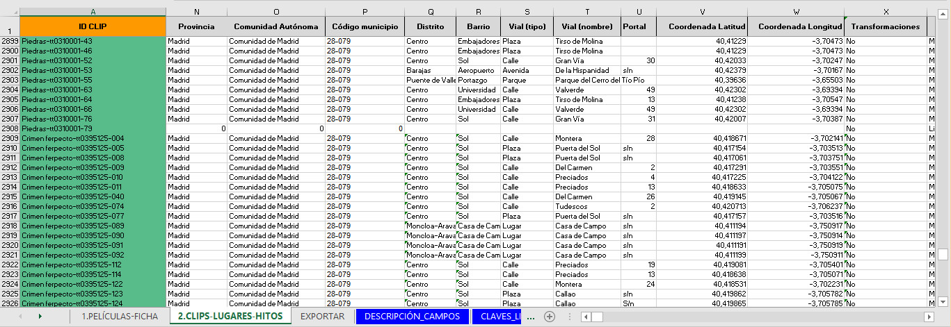
The process of identifying and assigning geographic coordinates for localizations was done through work with tools such as Google Maps, Google Earth, Street View, and, on occasion, fieldwork, and consultations with production teams and offices. In addition, we have enabled a tool for user collaboration in this process on our webpage: https://ficmatur.uc3m.es/en/lista_ficmatur.html.
Getting additional information through fieldwork
We select the localizations with the most notable transformations to take a current photo in order to examine changes when compared to the original frame.
Integrating data in a Geographic Information System (GIS)
Information obtained is processed by a Geographic Information System (QGIS, gvSIG and ArcGIS) so map viewers and static maps can be developed, as well as spatial and audiovisual analyses of the corpus.
Besides incorporating the coordinates into the GIS, processing the categories of analysis lets us make a complete or partial analysis of the corpus through a comparative study of different variables.
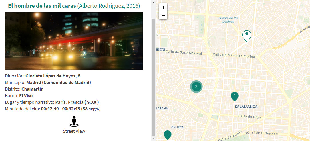
This is how the Madrid Audiovisual Map viewer has been conceived. Its search filters allow shootings in Madrid Region to be studied by combining different variables; or specific mappings for distinct processes (Viewer of Substitutions in the Madrid Region and the Transformations Viewer), origins (Madrid in non-Spanish speaking movies) or production companies (Location of Netflix series in the Madrid Region).